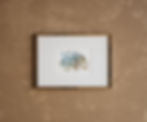
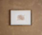
"Azalea Azimuth"
Size: 5" x 7"
Papercutting on archival paper with vintage map scrapbook paper for background.
The azimuth is the horizontal direction reckoned clockwise from the meridian plane. It is an angular measurement in a spherical coordinate system. Azimuth is also used as a celestial coordinate, and is the horizontal direction of a star or other astronomical object in the sky.
In navigation, the reference plan for an azimuth is typically true north, measured as a zero degree azimuth. Moving clockwise on a 360 degree circle, east has an azimuth of 90 degrees, south 180 degrees, and west 270 degrees.
The cartographical azimuth or grid azimuth (in decimal degrees) can be calculated when the coordinates of two points are known in a flat plat (cartographical coordinates) with a specific mathematical equation. Azimuths can be measured using a standard Brunton geo compass. Azimuths are measured and used in navigation, astronomy, engineering, mapping, mining, and ballistics.
Azimuth is yet another way of determining location and direction. May this "Azalea Azimuth" remind you that there isn't only one way to get to where you need to be in life. Life will change your direction and there are many tools to help you navigate the shifts and changes that life throws at you.
Created as part of the Cartography of Flowers Collection.
This papercut art piece is hand-cut from one sheet of white archival paper and matted with a printed colored vintage map of France. The floral bouquet is made up of one azalea flower surrounded by several simple generic flowers, flower buds, and leaves.
Azalea Azimuth
SIZE: 5" x 7"
MEDIUM: Papercut Archival and Scrapbook Paper
FRAME AND MAT NOT INCLUDED.


